Rainforest protection triples in size with more expansion planned
More indigenous communities than ever are using technology to protect their rainforest home.

Just the gist
If you're in a rush, here's what you need to know this month:
- Our project has expanded to two new communities: Bufeo Cocha and Santa Rita. Together they're actively protecting over 5,800 acres of Amazon rainforest– a bigger area than JFK international airport!
- Indigenous leaders from the Ticuna, Yagua, and Kitchwa peoples agreed to scale up their rainforest protection. They're planning to include 8 more communities, to protect over 35,000 acres of rainforest.
For more updates like this one, follow Wren on Twitter and Instagram.
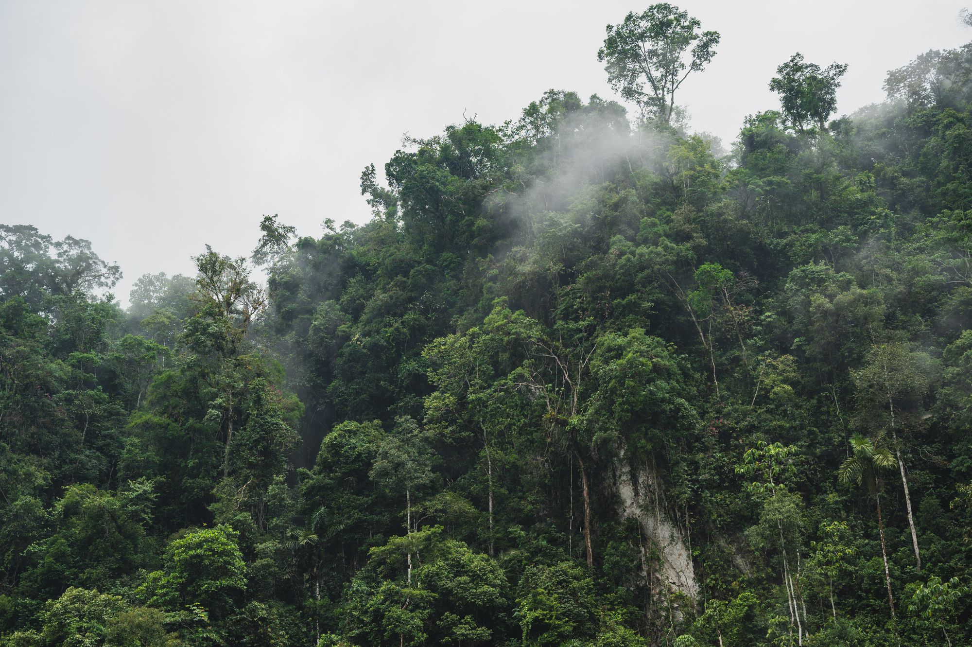
Since our last update from the ground, the Tech Enabled Rainforest Protection project has tripled their reach, with more expansion planned!
In this update, I'll introduce you to the two indigenous communities that recently joined our project. And I'll also cover the plans to protect tens of thousands more acres of rainforest across the Napo and Lower Amazon River Basins.
But first, let's recap this project. How do these communities protect so much rainforest anyway?
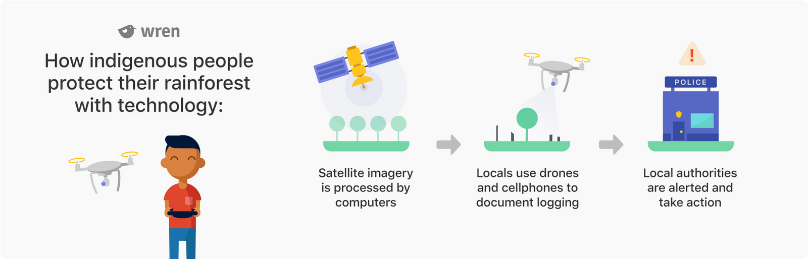
Recap: How tech-enabled rainforest protection works
- 🛰️ Indigenous technicians analyze satellite data to detect deforestation in their Amazon home. Then they send reports to local communities.
- 📱 Community monitors use the reports to investigate any deforestation using drones and smartphones.
- 🔄 Monitors report to their community assemblies. Communities report information to regional hubs. The hubs compile all the communities’ data, and let each community know about region-wide threats.
- 🗳️ The communities use a consensus model to decide on the appropriate response and take action. Each community is in charge. Each decides how they want to fight back against deforestation.
- 📊 Our project partner collects and analyzes the data to determine which interventions work best.
Tech-enabled rainforest protection expands to two new indigenous communities
The pilot program in Buen Jardin de Callaru has been running for over a year, and has successfully maintained a 0% deforestation rate since it started.
It didn't take long for neighboring communities to notice. Now, our project has expanded to include the nearby villages of Bufeo Cocha and Santa Rita. These three communities indigenous to the Lower Amazon River Basin are now protecting over 5,800 acres of rainforest. That's a lot of rainforest: if you were airdropped into the forest's centre at sunrise, it would take you a hard morning of walking to reach its edge.
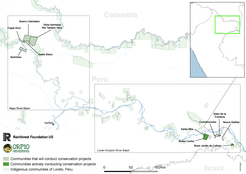
Indigenous leaders from across the Napo and Lower Amazon River Basins vote to scale-up the project
There are more deforestation threats than ever, due, in part, to the rising unemployment rate thanks to Covid-19. Indigenous peoples across Peru and Colombia want to defend their rainforest from illegal bands of loggers. Now, our project is giving them the tools to protect themselves.
At the end of last year, our project partner and the Indigenous Peoples' Organization of the Eastern Amazon convened a grand meeting. Indigenous leaders from the Ticuna, Yagua and Kitchwa communities of the Amazon spoke about how best to protect their Amazon rainforest home.
The vote was unanimous: the indigenous leaders agreed to expand our rainforest protection project to cover 8 more communities in the Napo and Lower Amazon River Basins.
"After I see what this initiative has done to support communities to protect their forests in the Lower Amazon, I know it will be a success in the Napo River basin. "
– Betty Perez Rubio, president of the Native Community Federation of the Napo Basin
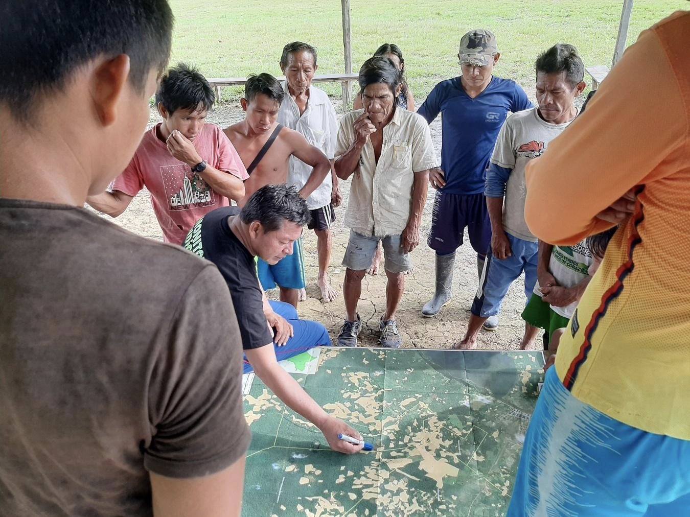
Our project partner, Rainforest Foundation US, took the opportunity to provide indigenous leaders with training, and detailed maps of their territories showing satellite-detected deforestation. The leaders are taking this knowledge back to their villages. Each village community will decide on a strategy to protect their rainforest home.
Our project partner expects these 8 indigenous communities will protect more than 35,000 acres of highly threatened forests across the Lower Amazon and Napo Basins– an area roughly 3/4 the size of Washington D.C!
In the next update, we'll see just how successful this project is.
That's all from me this time! If you have any questions, comments or feedback, please reply to this email. I'll get back to you as soon as I can.
– Thomas